The breaks
Recognised, publicly known surf spots around Outer Banks. Suitability depends on the day's swell, wind and tide, so treat the level as a guide, not a guarantee.
| Break | Type | Best for | Notes |
|---|---|---|---|
| S-Turns, Rodanthe | Sandbar beach break | Intermediate | North of Rodanthe, a well-known sandbar break on Hatteras Island. Crowded in summer and strongly dependent on sandbar shape. |
| Rodanthe Pier | Pier/beach break | Intermediate | The easternmost point of the Outer Banks. Works best on northeast winds and mid to high tides when the banks are good. |
| Pea Island and Irene's Inlet | Beach break | Intermediate | A quieter stretch within the wildlife refuge, with a newer inlet formed in 2011. Currents can be strong near inlets. |
| Cape Point, Buxton | Beach/point | Advanced | Where the beach swings round the cape. Powerful, current-prone and subject to seasonal closures. |
| Frisco | Beach break | Intermediate | Often a quieter option on Hatteras Island. Several banks suit longboards on smaller swells. |
| Jennette's Pier, Nags Head | Pier/beach break | Beginner–Intermediate | A convenient northern-beach break with cameras and conditions reports on the pier. Respect the pilings. |
Outer Banks surf climate, measured
Ten years of ocean model data for the open water off this coast: what the swell usually looks like before it reaches the beach. Shelter, sandbars and reefs change what you actually surf, so read this next to the month notes below.
| Month | Swell | Period | From | Wind | Water | Wetsuit | Days over 2.5 m |
|---|---|---|---|---|---|---|---|
| Jan | 1.4 m | 9 s | N | 28 km/h NW | 17°C | 3/2 mm full suit | 18% |
| Feb | 1.4 m | 7 s | SE | 32 km/h N | 16°C | 3/2 mm full suit | 3% |
| Mar | 1.2 m | 8 s | NE | 28 km/h NE | 17°C | 3/2 mm full suit | 5% |
| Apr | 1.4 m | 7 s | S | 29 km/h N | 18°C | 3/2 mm full suit | 10% |
| May | 1.0 m | 8 s | S | 23 km/h SW | 21°C | 2 mm shorty or spring suit | 3% |
| Jun | 1.0 m | 6 s | SW | 24 km/h SW | 25°C | Boardshorts | 0% |
| Jul | 0.9 m | 7 s | S | 20 km/h SW | 28°C | Boardshorts | 0% |
| Aug | 0.8 m | 7 s | SE | 18 km/h SW | 28°C | Boardshorts | 0% |
| Sep | 1.3 m | 10 s | E | 20 km/h NE | 26°C | Boardshorts | 3% |
| Oct | 1.4 m | 9 s | NE | 28 km/h NW | 23°C | Rash vest or 1 mm top | 5% |
| Nov | 1.3 m | 9 s | NE | 27 km/h N | 20°C | 2 mm shorty or spring suit | 8% |
| Dec | 1.4 m | 7 s | S | 30 km/h NW | 18°C | 3/2 mm full suit | 3% |
Median values from ERA5 at a sea point near Outer Banks (35.25°N, 75.5°W), sampled 4 days a month at 12:00 UTC, 2015-2024. Highlighted months are our suggested planning window. Not a forecast or a safety assessment. How we use this data.
Book a surf trip to Outer Banks
Everything we can link you to for this trip, grouped by what you need. Before you pay a camp or school, read who holds your money, and check that your insurance covers surfing.
Where to stay
Search near the breaks. Filter for surf hostels, apartments or hotels once you can see the map.
Surf lessons and activities
Listings change by season, so check what the operator includes and who coaches.
Flights
Add your dates and check the board fee on every leg before you pay.
Car hire
Ask about roof racks and whether the insurance covers boards on the roof.
Airport transfer
Tell the driver you have a board and its length when you book.
Mobile data
Download a forecast app and offline maps before you land.
Flight delay claims
If a delay eats your first surf day, check whether you can claim.
Luggage storage
Useful between check-out and a late flight. Check the size limit before dropping a board.
Links marked as partner links may earn us commission at no cost to you; the rest earn us nothing. We have not checked live availability or price, and the seller's terms apply. How we handle this.
A 200-mile string of islands in the open Atlantic
The Outer Banks are a chain of barrier islands and spits roughly 200 miles (320 km) long, separating the Atlantic from Currituck, Albemarle and Pamlico Sounds. They are made of sand, not rock, and are not protected by offshore reefs, so storms reshape the beaches regularly. The northern section, from Oregon Inlet northwards, is joined to the mainland; further south, Hatteras Island is a narrow strip with a single main road.
For surfers this has two consequences. The waves are beach breaks over sandbars, so quality depends on recent storms rather than on a fixed reef, and the coast juts so far out that it catches swells which miss most of the East Coast. That mix is why Hatteras is a standard stop for East Coast surfers chasing a hurricane swell.
Hatteras Island: Rodanthe to Cape Point
Hatteras Island is where most people go for serious surf. From north to south the main communities are Rodanthe, Waves, Salvo, Avon, Buxton, Frisco and Hatteras village. Rodanthe Pier is the easternmost point of the Outer Banks, and the S-Turns, just north of Rodanthe, are one of the better-known sandbar breaks. The Pea Island National Wildlife Refuge lies along the northern end of the island, with Irene's Inlet created when Hurricane Irene cut the island in 2011.
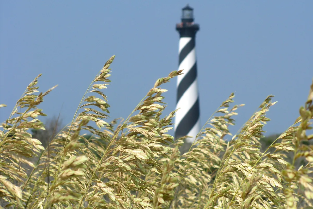
Further south, the Cape Hatteras Lighthouse in Buxton marks the elbow of the coast, and Cape Point, where the beach swings round and meets the Diamond Shoals, attracts surfers when the swell is up. Frisco is often described as the quieter alternative.
Nags Head, Kitty Hawk and the northern beaches
North of Oregon Inlet the towns of Nags Head, Kill Devil Hills, Kitty Hawk and Duck are more developed and busier in summer, and the beaches face east. Jennette's Pier at Nags Head is a favourite reference point for surfers because the pier has cameras on each side and publishes wind, tide and water temperature information.
Piers shape sandbars and rips, and surfers often use the gaps beside them, but they can also be hazardous in bigger waves, so give pilings a wide berth. South Nags Head and Coquina Beach, near the Bodie Island Lighthouse, offer less developed stretches. The northern beaches are a good place for families and for people who want lessons and rentals close at hand.
Hurricanes, nor'easters and the swell calendar
The Outer Banks is the most hurricane-prone part of the US coast north of Florida, and storms passing offshore send long-period swell that can produce some of the best surf in the region. Late summer and autumn are the busiest times for these swells, with September and October the usual peak for Atlantic hurricanes. The same storms can close roads and force evacuations, so a hurricane swell trip is a gamble and requires flexibility.
In winter, nor'easters build the largest waves of the year, often with cold, stormy weather and onshore winds. Spring brings mixed swell and often a cold ocean. Summer is the calmest season, usually small and mushy, though a distant tropical system can add a few good days.
Cold winters, mild autumns: choosing a wetsuit
Because the Gulf Stream runs relatively close to Cape Hatteras, water can be mild in summer and early autumn, and in many places a swimsuit is enough between late June and early October. Winter is a different story, with water temperatures often falling to roughly 9 to 13°C. Most surfers wear a full winter wetsuit with boots, gloves and a hood from December to March.
Spring and autumn are in between. A 3/2 is a common choice in the shoulder seasons, though cold fronts can drop the temperature quickly. Check the water temperature from a pier camera or buoy before you pack, and bring an extra layer for the wind, which can feel cold after a session.
Getting to the islands and getting around
The nearest major airport for most visitors is Norfolk in Virginia, around a two-hour drive to the northern beaches, and further to Hatteras Island. Small airfields on the islands serve private aircraft. Wright Memorial Bridge carries US 158 from Point Harbor to Kitty Hawk, and from Whalebone Junction NC 12 runs south across Oregon Inlet and along Hatteras Island.
NC 12 can be closed after storms, especially between Nags Head and Rodanthe, because of overwash and erosion. Free state ferries link Hatteras to Ocracoke Island. Check road and ferry status before travelling, and keep some flexibility in your schedule. A car is essential, since the breaks are spread over many miles and public transport is minimal.
Beach driving, wildlife rules and other practicalities
Much of the Hatteras coastline is part of the Cape Hatteras National Seashore, which has its own rules. Off-road vehicle access on certain beaches needs a permit, and some stretches are closed seasonally to protect nesting birds and turtles. Check the National Park Service website for current closures before you plan a dawn drive to a remote bank.
Amenities are limited on the island outside the villages. Fill the tank and buy supplies at the larger shops, and note that rental houses fill up for summer. Tourism is a big part of the economy, with a large share of local jobs in Dare County depending on visitors, so most services shut down or reduce hours in the quieter months.
Outer Banks surf season month by month
A broad planning picture, not a forecast. Swell, wind and water temperature vary from year to year.
| January | Cold water, often 9 to 11°C, and strong nor'easters. Waves can be big, and only experienced surfers with full winter gear should go. |
|---|---|
| February | Winter storms continue, with cold, windy conditions and big swell on some days. Few visitors and quiet beaches. |
| March | A mixed month with winter storms and early spring swell. Water remains cold, and winds are changeable. |
| April | Spring brings milder weather but cold water. Swells are inconsistent, and the beaches are mostly empty. |
| May | Warming slowly, with smaller waves. A 3/2 or spring suit is enough for many sessions. Sandbars are in transition. |
| June | Early summer, small waves and warming water. Good for learners and beginners, with lessons available at the northern beaches. |
| July | Peak summer. Mostly small and busy. A tropical system offshore can add a few good days. |
| August | Hurricane season builds. Water is warmest, with a few swell events possible, but the beaches are crowded. |
| September | Prime time: hurricane swell, warm water and thinner crowds after Labor Day. Storms can also bring road closures. |
| October | Often the best month, with clean swells, warm-ish water and offshore days. Hatteras Island attracts surfers from across the East Coast. |
| November | Cooling water and the first nor'easters. A 4/3 becomes standard, and the beaches are quiet. |
| December | Cold and stormy, with large swells possible. Short days and few services open, so plan accordingly. |
Learning to surf on the Outer Banks
Summer is the learning season here. Waves are small, the water is warm and several surf schools run lessons on Hatteras Island, at Rodanthe and Buxton, and at the northern beaches in Kitty Hawk and Nags Head. Group lessons usually run for around two hours with a soft board, and many schools also offer private coaching.
Because the waves are beach breaks, learners practise in the white water close to shore. Ask the school about rip currents and whether a lifeguard is on duty, since many Outer Banks beaches have limited or seasonal patrols.
When you can stand reliably, you can start to look for green waves in the line-up. Stay away from pier pilings and from inlets, where tidal currents can be strong. A hurricane swell week is not the time to be a beginner.
Comparing options across the country? Read our guide to surfing in the USA.
Seasonal notes on this page describe typical patterns, not the conditions on a given day. Use the local forecast, lifeguard advice and a qualified instructor for water-safety decisions, and get a written breakdown of what any surf package includes before paying.
Outer Banks surf trip questions
When is the best time to surf the Outer Banks?
September to November is considered prime, with hurricane swell, warm water and fewer visitors. Winter has the largest waves but is cold and stormy, while June and July are small and suit beginners.
Do I need a wetsuit on the Outer Banks?
From late June to early October, a swimsuit is often enough. In spring and autumn a 3/2 is typical, and in winter you will want a full 5/4 with boots, gloves and a hood.
Are there lifeguards on Outer Banks beaches?
Some beaches have lifeguards in the summer season, but coverage is patchy and many stretches have none. Always check for rip currents before entering the water and avoid surfing alone.
Can hurricanes close the roads?
Yes. Storms can wash out NC 12 and cut Hatteras Island, as Hurricane Isabel did in 2003 and Irene in 2011. Check road and ferry updates and keep your plans flexible.
How do I get to the Outer Banks?
Most visitors fly to Norfolk, Virginia, and drive about two hours to the northern beaches, longer to Hatteras Island. A car is essential, and the roads can be congested at summer weekends.
Sources & editorial notes
Destination context checked against the sources below. Base-selection and itinerary suggestions are Book & Surf editorial recommendations. Seasonal windows are broad planning suggestions, not measured forecasts or guarantees.
- Wikipedia: Outer Banks ↗
- Wikipedia: Hatteras Island ↗
- OuterBanks.com: Surfing in the Outer Banks ↗
- National Park Service: Cape Hatteras National Seashore ↗
We do not claim to have personally surfed every break. Read our editorial standards.